This coming hunting season I’ll be chasing whitetails in Ohio, Iowa, and Michigan. And despite the fact that I’m currently living in Idaho, this past week I scouted all three states.
No, I didn’t put three thousand miles on my car—all I did was fire up my laptop, connect to the internet, and pull up a few maps. Maps are the serious deer hunter’s best friend, especially when it comes to scouting, and in today’s digital world there are a plethora of online mapping options available with just the click of a mouse. Here are three tools to help you scout and hunt better this year.
1. Aerial Maps
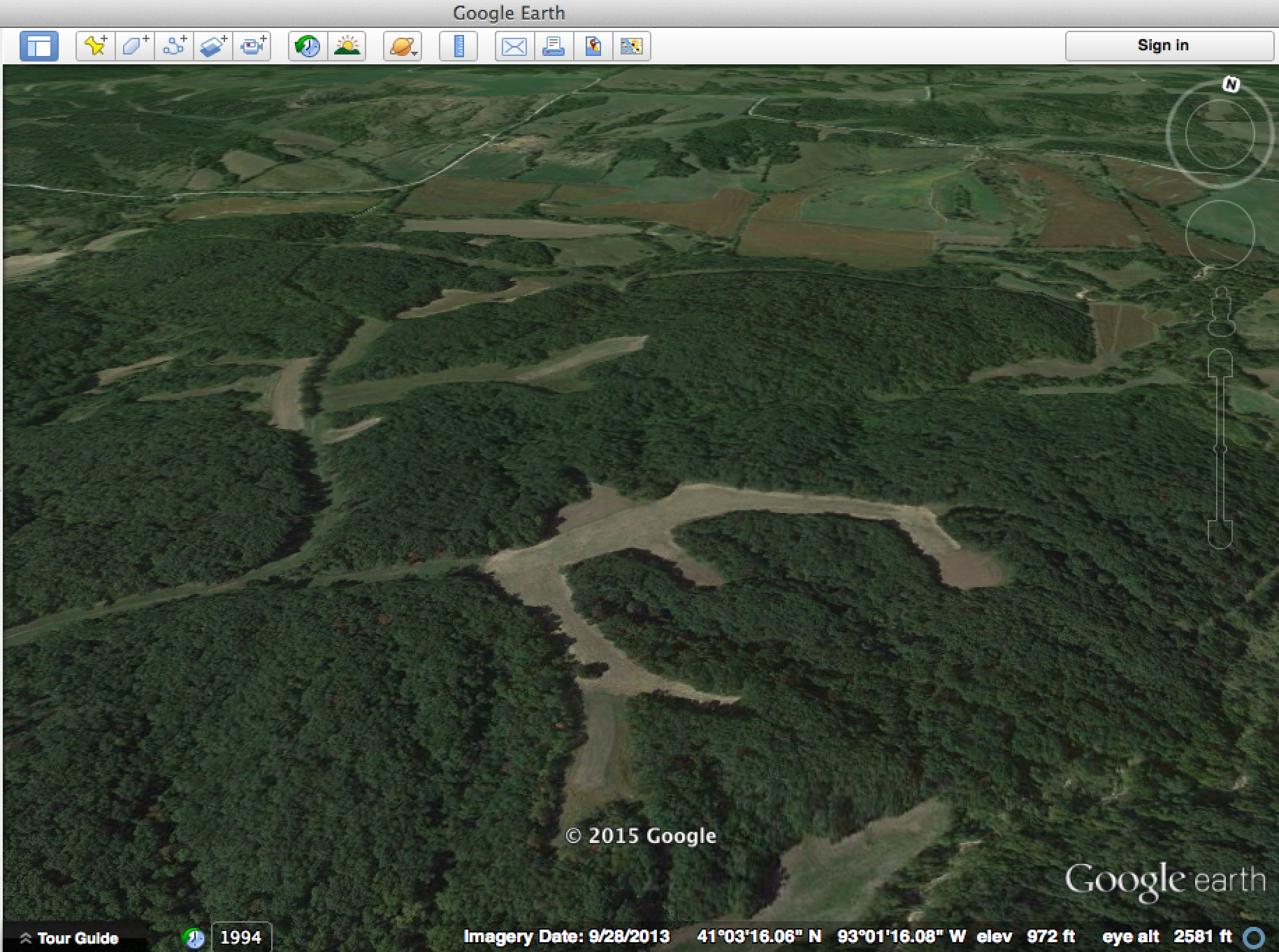
The online maps I use most often when scouting digitally are aerial imagery from Google Maps and Google Earth. Both of these tools allow you to clearly see a bird’s eye view of your hunting properties, which showcase the cover, crops, water sources, trails and even, to a degree, the topography. Google Earth is the better option of the two if you’re interested in topography, because it creates a 3D rendering of the terrain and allows you to zoom in and change your perspective from different viewpoints. In addition to Google Maps and Earth, Bing Maps offers some solid aerial imagery with slightly different, more angled views.
With these kinds of maps you’ll easily be able to identify food sources, as well as potential bedding areas, funnels, and much more. Use this aerial view to identify potential stand sites, and then when you do get a chance to visit the property in person, scout these areas and confirm if the on-the-ground sign is as strong as you expected.
2. Topographic Maps
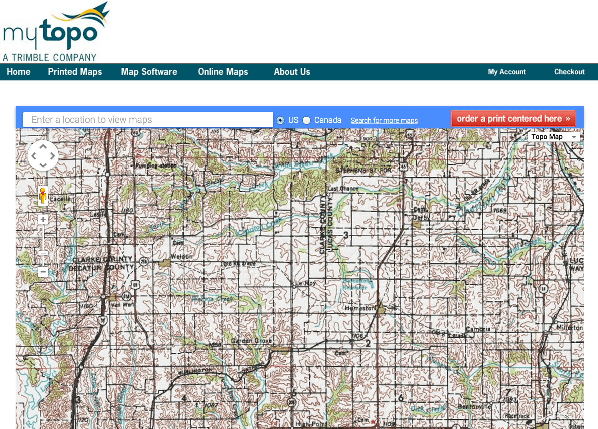
If a property has lots of topography—hills, ridges, valleys, etc.— then true topographic maps can be a tremendous asset. With the aid of carefully spaced lines showing changes in elevation, topographic maps can allow you to clearly identify terrain features that funnel deer movement. You can buy print topographic maps from many retailers, but you can also access free topo maps with online sites like MyTopo.com and CalTopo.com.
Ridgelines, saddles, points, high ground in swamps, and many other types of topographic feature can all be identified with these maps. Combined with aerial imagery, these maps can give you a surprisingly accurate idea of how deer will travel across a property (assuming you understand how deer relate to these features, that is.)
3. GIS Maps
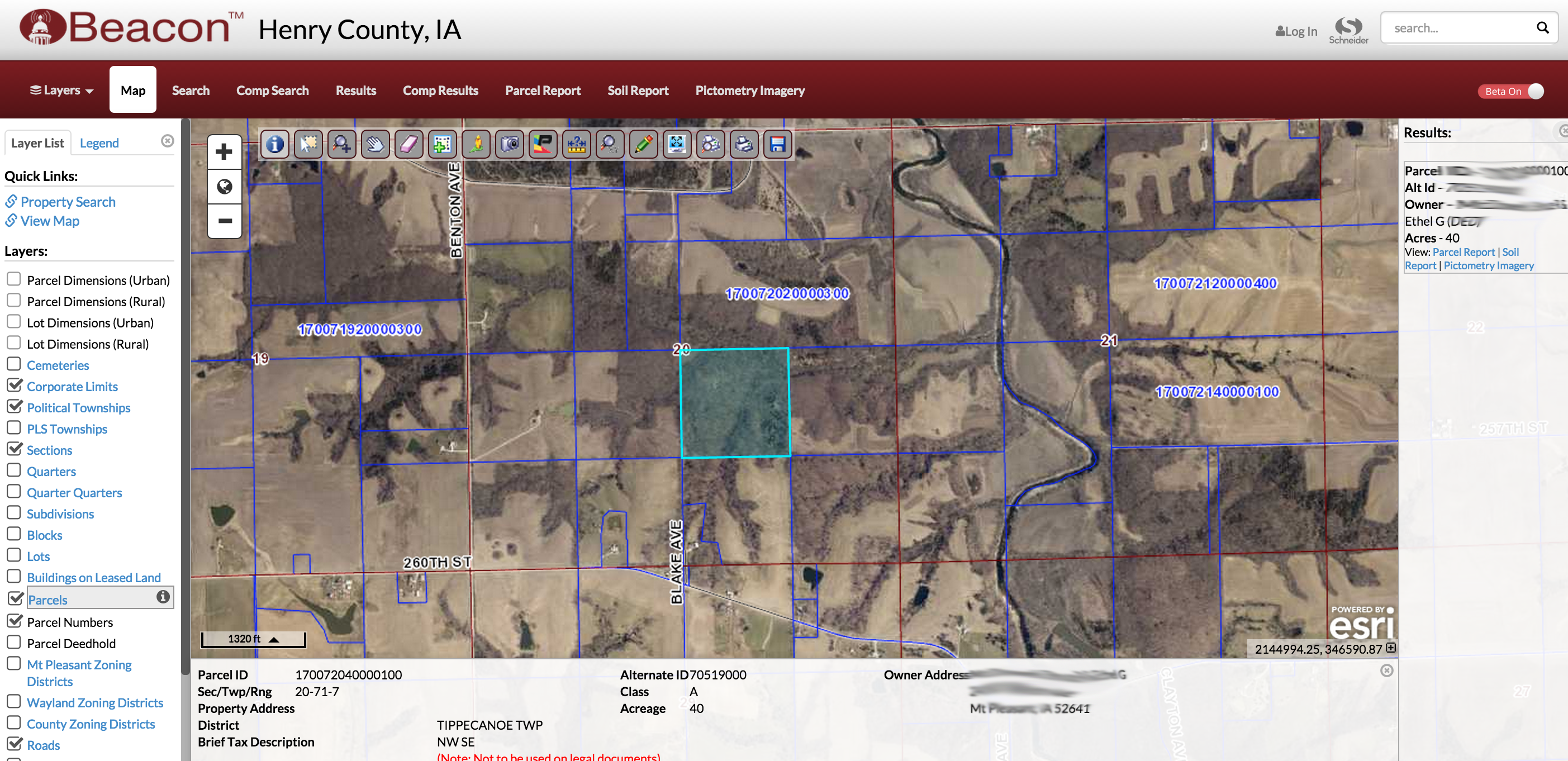
GIS tools, or “geographic information systems,” are provided by most counties across America, and the mapping systems within are what deer hunters will be most interested in reviewing. With an online GIS map you can see property borders, landowner information, acreage amounts and much more property related information. This kind of information can come in very useful if you’re looking to buy, lease, or just find land to ask permission on. There are also typically measurement tools that allow you to outline an area and get acreage measurement, which is particularly helpful if you’re trying to measure the size of a food plot or some other part of your property.
When in need of GIS information, I typically go to Google.com and search for “GIS map” and then the county I’m looking for. This almost always turns up the local GIS option for that area.