We may earn revenue from the products available on this page and participate in affiliate programs. Learn More ›
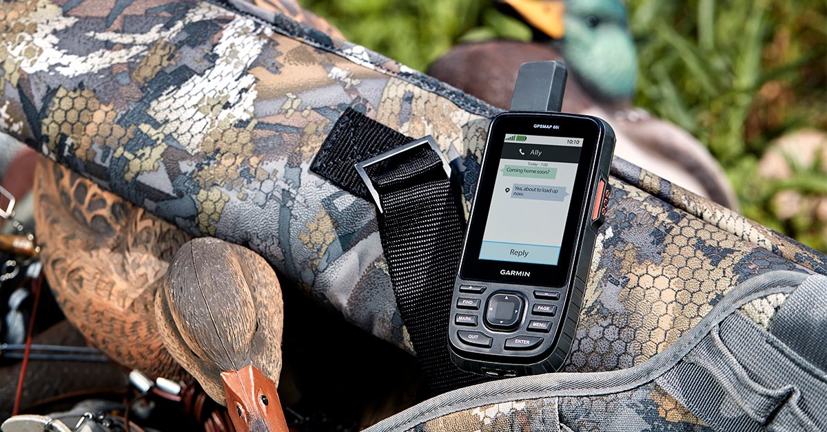
It wasn’t that long ago that the GPS navigation technology available to hunters, fishers, and backpackers offered little more than gray, pixelated screens, with only the most basic navigation and waypoint functions. Many early models didn’t even have maps, but the game has changed, and a good GPS unit for your particular application can help you safely and effectively hunt and fish. The wide variety of portable GPS devices and apps available is daunting, but with a little context and intention, you can narrow your search down to the best options that will work for you. Here are some of the best options out there for hunters, anglers, and outdoors people. Today, the best GPS for hunting or fishing come in many different forms, including wristwatches and what you’re probably reading this on right now, your phone.
- Best Handheld GPS Unit: Garmin inReach Explorer+
- Best Lightweight GPS Unit: Garmin inReach Mini 2
- Best for ATV: Garmin Montana 700i
- Best for Fishing: Humminbird Helix 7
- Best GPS Watch: Garmin Fenix 7 Sapphire Solar
- Best GPS App: OnX Hunt or Backcountry
- Best Free: BaseMap
- Best Dog Tracker: Garmin Alpha 200i
What to Consider Before Buying a GPS Device
While only a few years ago people had to purchase separate satellite messengers and GPS devices, users now have the option to purchase these devices as a combined unit. Of course, getting an integrated device still costs more over the long haul than a one-and-done PLB, but for many the weight savings more than makes up for it.
Satellite Messengers
Many satellite messengers incorporate a GPS function, so if you plan to carry both of these devices with you into the backcountry, it makes sense to carry them as an integrated unit.
GPS Apps
There are an ever increasing number of excellent GPS apps on the market, including OnX Backcountry, Gaia GPS, AllTrails, BaseCamp, and CalTopo. Depending on your needs (and comfort in relying on your smartphone for GPS support), these can work well for day-long or even two-day long adventures (after that, the toll on your phone’s battery means you should consider one of the best power banks for camping).
GPS Watches
The demand-driven progress of GPS watches has been another contemporary marvel. A little wristwatch can do far more functional work than the most expensive handheld GPS could do just a few years ago. Smartwatches have a wide variety of functions in everyday life, and with GPS built in, they can provide valuable tools for backcountry users. A GPS watch’s practicality is often limited by battery life and a small display, so they sometimes aren’t suited for a person’s sole GPS, but they are ideal for runners, hikers, and other users who want to track their physiological statistics as well as maintain the functions of a normal GPS.
Best GPS for Hunters & Anglers: Reviews & Recommendations
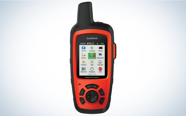
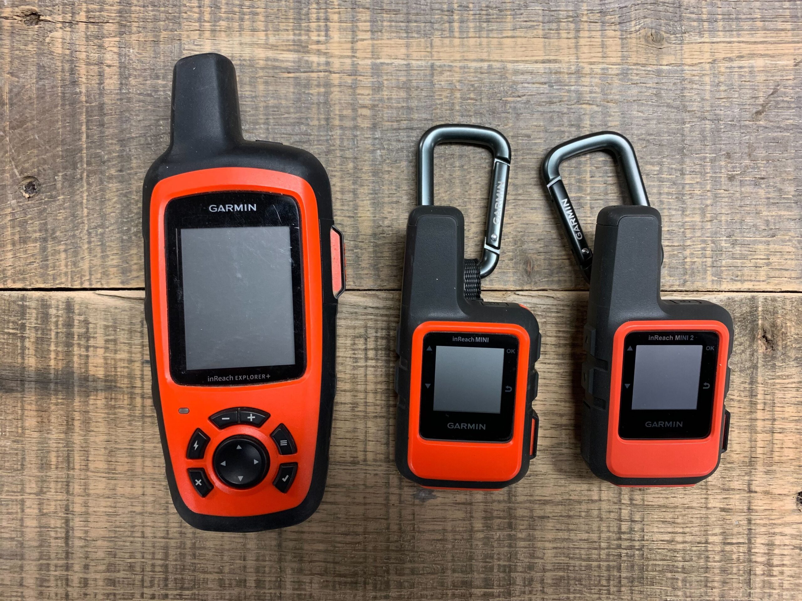
Best Handheld GPS Unit: Garmin inReach Explorer+
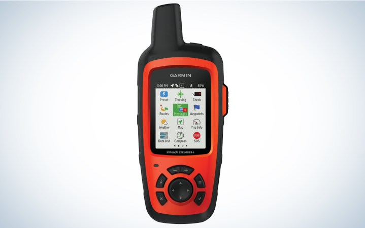
Key Features
- Weight: 7.5 ounces
- Display size: 1.4 inches x 1.9 inches
- Display resolution: 200 x 265 pixels
- Battery: Rechargeable internal lithium-ion
Pros
- Has satellite messenger ability
- Pair with your phone using the Garmin Earthmate app
Cons
- Expensive
Garmin’s inReach Explorer set the standard for combining handheld GPS units with satellite messaging technology. It is without question the most popular GPS option for those who commonly hunt, fish, or travel in remote, rugged areas with little or no cell service. These Garmin GPS units (and all that utilize the inReach technology) work off of the Iridium satellite network to communicate via text message, retrieve detailed weather forecasts, and feature an SOS feature that summons rescue in case of emergency.
The original inReach Explorer is a fairly typical-sized handheld GPS with a screen that is smaller than many other units and no touchscreen. It does have an adequate display with a variety of map options, as well as a hunt-and-peck keyboard display for messaging, but is more user friendly when using with your smartphone via Bluetooth and the Garmin Earthmate app, which allows you to use essentially all of the unit’s functions through the convenience of your phone.
Best Lightweight GPS Unit: Garmin inReach Mini 2

Key Features
- Weight: 3.5 ounces
- Display size: .9 inch x .9 inch
- Display resolution: 176 x 176 pixels
- Battery: Rechargeable internal lithium ion
Pros
- Has satellite messenger ability
- Pair with your phone using the Garmin Earthmate app
Cons
- Breadcrumb map only
Tyler Freel took a look at the Garmin inReach Mini 2 and came back impressed with how the unit had improved over the original model. He noted that the inReach Mini 2 works best when paired with your smartphone via the Garmin Explore app, especially for more complete GPS functions and mapping, including the ability to download a variety of map layers including Topo North America, USGS Quad Sheets, and even aerial imagery for some areas. (He did find that the Mini 2 was easier to use without a mobile device than the Mini.)
One change with the Mini 2 is the addition of a “passive” trackback feature on the Mini 2, which allows you to backtrack along a track you’ve already made, even if you don’t currently have active tracking enabled. If you need to retrace your steps, you can recall them for up to 24 hours. Even better: To make location acquisition and satellite connection faster in remote places, the inReach Mini 2 connects to three different satellite networks in addition to GPS and Iridium communication satellites. You might not see a perceptible difference in connection times in some areas, but in steep mountain canyons, or other areas with limited direct visibility of the sky it can make a big difference. What the Mini 2 lacks is the option to have a basic topographic map on the unit, even with the small screen: You won’t have access to the full power and function of the Mini 2 without using it with a smartphone.
Best for ATV: Garmin Montana 700i
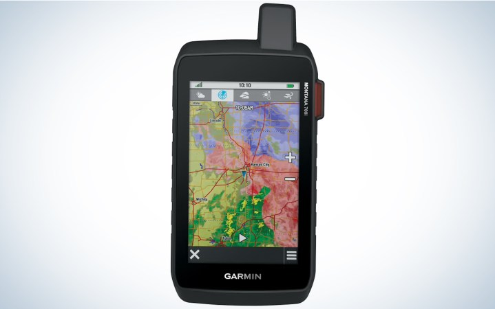
Key Features
- Weight: 14.5 ounces
- Display size: 2.55 inches x 4.25 inches
- Display resolution: 480 x 800 pixels
- Battery: rechargeable lithium-ion
Pros
- Long-lasting battery
- Larger screen that works well in a vehicle
Cons
- Heavy
- Expensive
If you’re looking for a handheld GPS that can serve primarily as a vehicle-based unit for navigation, take a look at the Montana 700i. This rugged unit features a robust design, 2.55-inch x 4.25-inch large touchscreen display. It weighs just shy of a pound, so it’s not going to be a backpacker’s best friend, but mounted in your vehicle, ATV, or UTV, or boat, it’s a great, flexible tool for navigation. The Montana 700i has a variety of available navigation maps as well as topographical and satellite image maps available.
It also has a full digital keyboard to make on-device messaging easier, and features all the messaging, weather, and SOS capabilities of the other inReach devices, if you choose that option. The lithium-ion battery pack provides up to 18 hours of operation in GPS mode, and up to 330 hours in Expedition mode. It has a slew of other features such as map sharing and dog tracking, and you can even get one with an 8 mega-pixel camera to give your waypoints an on-board visual.
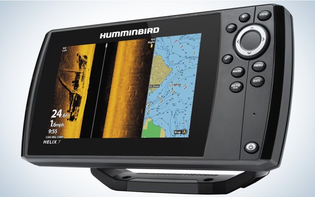
Best for Fishing: Humminbird Helix 7

Key Features
- Weight: 5.7 pounds
- Display size: 7-inch diagonal measurement
- Display resolution: 800 x 480 pixels
- Battery: Not included
Pros
- Functions as a fish finder and GPS in one
Cons
- Expensive
- Not an ideal option for activities beyond fishing
If a dedicated fishing GPS unit is what you’re looking for, take a hard look at the Helix 7 All-Season from Humminbird. On the surface, this unit is more of a fish-finder than a dedicated 7 inch GPS, but the way it combines features makes it a great option for ice fishing, open water, and especially for someone who does both. It uses both open-water and ice transducers to function as a fish-finder or flasher, but its GPS and mapping make it an extremely effective and valuable tool. Anglers can download pre-charted lake maps, and even some that other users share, but the unit allows an angler to accurately create and save a chart of the water they are fishing with the Auto-Chart Live. Using an open-water transducer from a boat, you can create and save detailed charts on the unit, then come back and fish the exact spots you want to in the winter. The unit can run mounted to your boat or snowmobile or in the portable ice kit with external battery either on the ice or in a canoe, using a suction-cup transducer attachment. There certainly are more specialized fish-finder and GPS units out there, but it’s hard to beat the flexibility of this one.
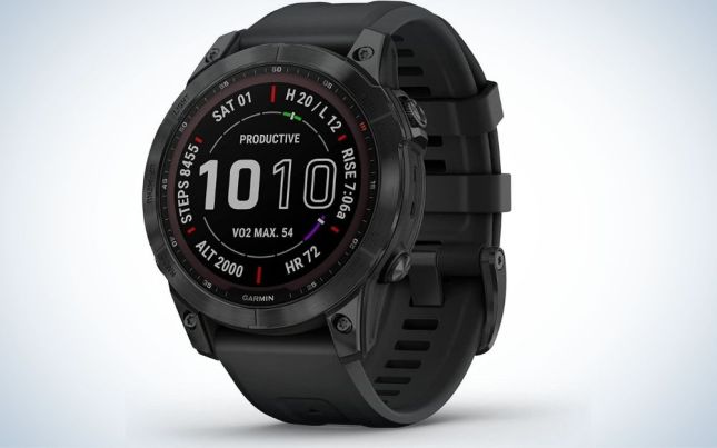
Best GPS Watch: Garmin Fenix 7 Sapphire Solar
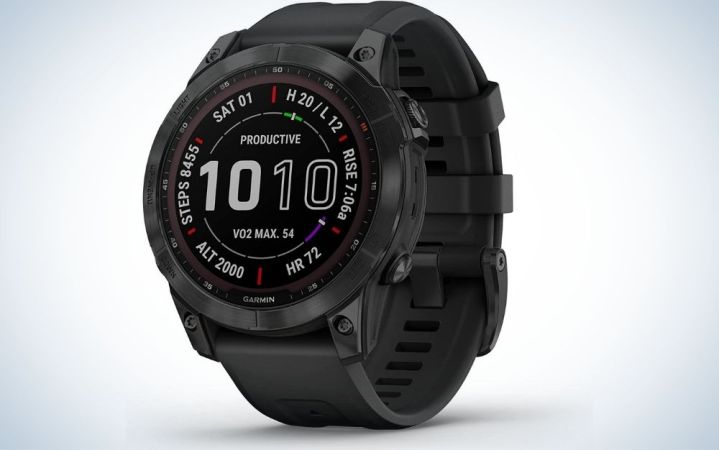
Key Features
- Solar powered (up to 37 days of battery life in smartwatch mode)
- Three different size options
- Touch screen
- Flashlight (on large “X” size)
- Multi-band GPS and preloaded Topo maps (on Sapphire model only)
- Format settings on your phone
- Variety of health tracking features and programs
Pros
- Incredible number of features and apps
- Accurate GPS mapping and easy navigation
- Compatible with other Garmin devices like dog e-collars and inReach
- Rugged, durable construction
- Long battery life
Cons
- Pricey
- Hefty
- Not for beginner smartwatch users
If James Bond was into outdoor recreation and fitness, the Garmin Fenix 7 Sapphire Solar would be his watch (it’s also the OL pick for one of the top watches with GPS). Garmin’s new line of Fenix watches includes three different models (Standard, Solar, Sapphire Solar). Each model is offered in three different sizes. There are too many variations to get into, so I’ll stick with the model I tested, the Fenix 7 Sapphire Solar, which is the high-end version. This model has sapphire lens material and titanium bezel material. It has a larger and more efficient solar panel than previous Garmin models.
I’ve used this watch for a little over a month and am still digging into all of its features. On the upside, general setup was quick and painless. I navigated through the watches setting options and then paired it with my phone through Garmin’s Connect app. The first thing I did was take it for a run through one of my regular routes and was happy to see the watch tracked perfectly. As it should. The Sapphire Solar uses multi-band GPS, which can access more than one range of frequencies from different constellations of satellites (most GPS systems use a single connection to the satellites). In other words, it utilizes more powerful GPS technology that should mean faster and more accurate navigation. While navigating on hikes, the touch-screen feature made moving around the topo map (which comes pre-loaded on the watch) a breeze.
Like all other smart watch options, the Sapphire Solar has a variety of fitness and health metrics you can track and tinker with (though its offerings go deeper than most). But this watch is a bit heftier and quite a bit more expensive than most other smartwatches. Where the Fenix Sapphire Solar really sets itself apart is with its rugged construction, improved solar charging, and powerful GPS. So if the world (of standard GPS watches) is not enough, then you should go with the Fenix Sapphire Solar. —Alex Robinson
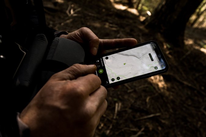
Best GPS App: OnX Hunt or Backcountry

Key Features
- Weight: None
- Screen Size and Resolution: Same as your phone
- Battery: Easily rechargeable with the best power banks for camping
Pros
- Less expensive than other options
- No need to carry an extra device in your pack
Cons
- If your phone battery dies in the backcountry, you’re SOL
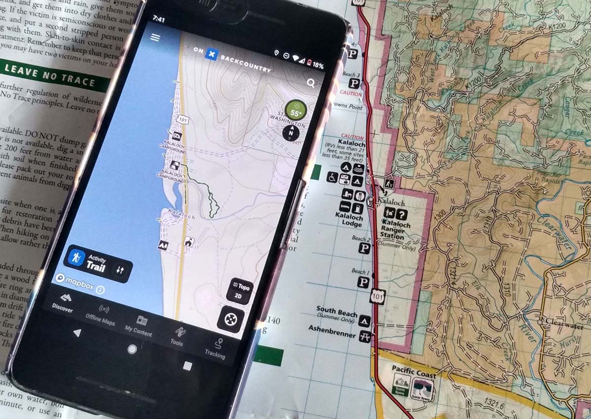
More and more backpackers and hunters are realizing that the easiest way to save weight on a GPS unit is simply not to carry one at all. Fortunately, the current generation of map apps has more than enough functionality for the vast majority of outdoor users. Instead of purchasing a separate device, you simply download the relevant app to your phone, pay a monthly or yearly subscription cost (or don’t, if you find the free versions of the maps provide enough detail) and start planning your trip. For excursions that take you off the grid, there is also the option to download maps (at various sizes and resolutions) to your phone. The OL preference is for the OnX Backcountry suite of apps, both due to their performance and their advocacy for land use. The Hunt version of their app has been a mainstay for sportsmen for years, and the Offoad and Backcountry versions are quickly gaining popularity with offroaders, car campers, and backpackers, as well as a GPS for hiking Whether you are backpacking in a national park or sharing the spot in the woods where you last heard that turkey gobble, OnX has got the app you need. —Laura Lancaster
Best Free: BaseMap
Key Features
- Weight: None
- Screen Size and Resolution: Same as your phone
- Battery: Your phone
Pros
- Free
Cons
- Option to upgrade for even more features
- User friendly
Several popular options provide a lot of the same information, but recently, BaseMap has become my favorite. The app is free with basic functions, but for about $30 per year you get access to the full features. The app presents you with a high-quality satellite image with a tracking icon at your location. You can add multiple map layers, including public and private land boundaries, property information, roads, trails, waterways, historic wildfires, and other state-specific info. It features an intuitive navigation aid that lays out both azimuth and distance over the map, showing you quickly how far you are from point A to B. It’s user-friendly and a tool that just about any hunter will find worth having.
Best Dog Tracker: Garmin Alpha 200i
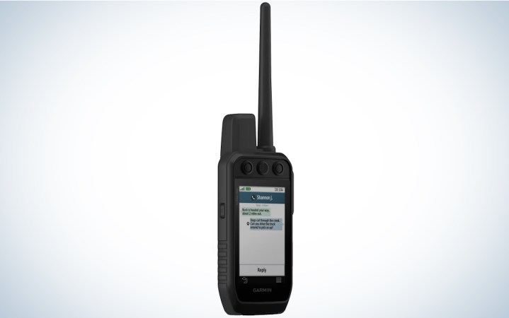
Key Features
- External top and side buttons
- 9-mile range when paired with Garmin’s latest TT15x collars
- Tracks up to 20 dogs/collars
- Cell service not needed
- All maps come pre-loaded
- Integrated inReach capability
Pros
- Does almost anything you need from a track and train system
- Highly customizable
- Easy-to-use buttons
- More accessible for tracking hunting partners and/or their dogs
Cons
- Pricey
- Maps and screen clarity lacks compared to smartphone options
- Complex set up and navigation
- Lacks integration options with non-Garmin products
For those already sold on Garmin products who need an all-in-one track and train option, the Alpha 200i beats the masses. It’s our pick for the top GPS trackers for dogs (and further impressed Gear Editor Scott Einsmann), and is compatible with Garmin TT 15X collars, which have up to an 8 hour battery life and 9 mile range. Garmin improved the features that won fans in the Alpha 100 and addressed the most commonly cited weaknesses of that unit, the in-field e-collar/training functions.
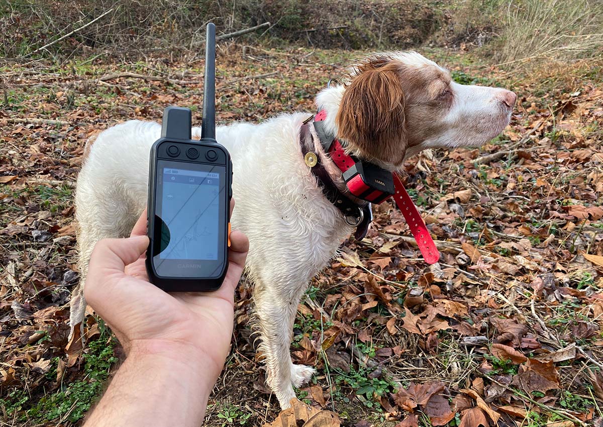
The previous unit’s reliance on its touchscreen to change stimulation levels was a turn-off for many of us. But I like the Alpha 200i’s more efficient activation of stimulation that I think better serves hunting dog owners who use it to communicate with their dogs in situation-appropriate ways. That’s a game changer for pointing dog owners whose training systems depend on silent command (e-collar) communication.
Features to Consider
Two-Way Texting
Some handheld GPS units incorporate some form of two-way communication, a potentially lifesaving feature. Using vast satellite networks, users can send and receive text messages to any cell phone or email address in the world regardless of cell or wireless coverage. In an emergency, that can spell the difference between life and death.
In a worst-case scenario such as a plane crash, blizzard, or backcountry accident, there is no better insurance than a handheld GPS with an SOS feature. State-of-the-art units function as a beacon, where the press of a button sends an emergency signal with coordinates to a 24/7 monitoring network. That initiates two-way communication, with which survivors and first responders can coordinate rescue.
Maps
While you will undoubtedly want to load and customize your own maps on any GPS, you can download starting points for almost anything in the world. Those are only a start, however, as the GPS market offers a mind-boggling array of both free and paid maps to expand your horizons.
Keep in mind that maps are continuously updated, both with improved levels of information and to reflect new conditions due to geological changes, deforestation, or updated property lines or information. Also be sure to check with local land agencies before using your GPS tracker on a new trail, as not all GPS maps provide sufficient level of detail for navigation.
Screen Size
The lightest weight handheld GPS units typically have very small screens, which can make identifying your next waypoint or tracking progress along a particularly tricky stretch of terrain difficult. Choose a hiking GPS with a larger screen if you plan to use it as your primary source of navigation. If your GPS unit will mainly serve as backup to a traditional map and compass setup, then having a smaller one may work well.
Carrying a paper map gives you the big picture view of your surroundings, allowing you to more easily identify distant peaks or understand what the elevation changes for the following day will feel like.
FAQs
BaseMap and OnX are two of the best all-around hunting map apps. BaseMap offers a free version and a $30 annual subscription with full features. OnX offers subscription plans from $30 to $100 annually. HuntStand is the best app for deer hunters who want to keep track of stands, trail cameras, and food plots and then share that information with their buddies.
The easiest GPS to use for hunting is a mobile app like BaseMap. The Garmin inReach is also an easy GPS to use for hunters going off-grid.
First determine your budget and the features you need from a GPS. This will narrow down your selection, and then you can choose from our picks of the best GPS for hunting and fishing.
Outdoor adventurers know that Google Maps is useless the second you leave pavement. Not only is it not a reasonable choice as a hiking GPS (it’s almost completely worthless, in fact), it’s also not a reliable tool for navigation if you’re planning to drive on forest service, logging, or Jeep roads. Using Google Maps to navigate to a remote set of GPS coordinates could, in fact, be downright dangerous, as is using it to take shortcuts off of major highways in remote areas.
Why Trust Outdoor Life?
Since 1898, OL has been a leading authority in testing and reviewing hunting gear, fishing tackle, guns and shooting equipment, and much more. We have more than a century-long history of evaluating products, and we’re now bringing that expertise to online reviews. Our editors are experienced outdoorsmen and women, and most importantly, we’re trained journalists. We prioritize field testing and objective data when reviewing products. We conduct interviews with gear manufacturers and engineers as well as outdoor experts so that our readers have an understanding of how and why a product works—or doesn’t.
Advertising does not influence our gear reviews and it never will. While we always focus our coverage on standout products—because we want our readers to be aware of the latest and greatest gear—we also cover the flaws and quirks of any given product.
Final Thoughts on the Best GPS
Your GPS choice depends on your use case. If you’re using it as a backup to a paper map, a Garmin inReach mini is a great option. If you need one for your ATV the Garmin Montana 700i is your best choice. For casual everyday use, a GPS watch like the Suunto Baro 9 is a fantastic unit. Check each of them out by clicking the links above.