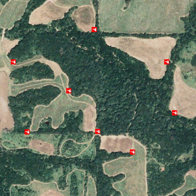
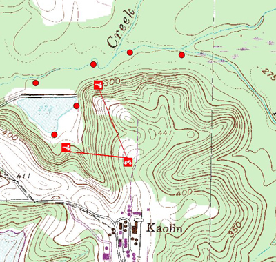
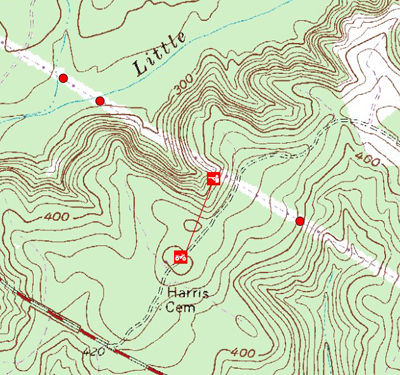
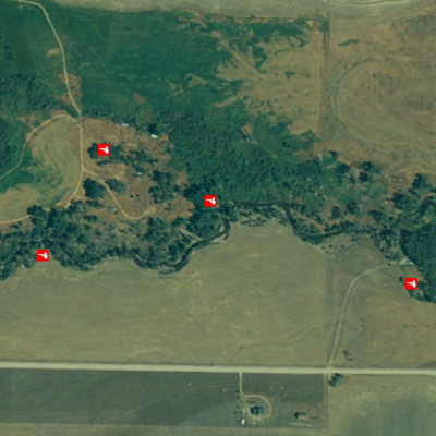
This is a Missouri hot spot, with most stands overlooking CRP and cornfields. The line of heavy timber is a thick hardwood bottom where deer live and feed. However, during the rut, bucks regularly cruise the field edges, and several 160-inch whitetails have been shot here. Note stand sites allow for long-range rifle shots. Yet even on woods-field edges bowhunters have taken a number of P&Y; bucks. Editor's Note: The internet is a huge asset for deer hunters, especially map-minded modern whitetail seekers. Mytopo.com (phone 877-587-9004) is one of the most remarkable tools a deer hunter seeking maps can utilize. For very little money, sportsmen can pinpoint hunting land with topos and aerial photos, find potential hunting spots, and even get exacting GPS coordinates of the locations in mere minutes. For a small fee, maps can be printed and laminated by the site, sent to you, and you're all set for fast, efficient woods scouting. Outdoor Life Online Editor
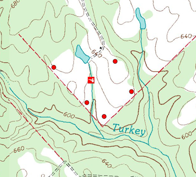
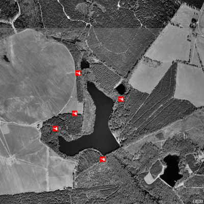
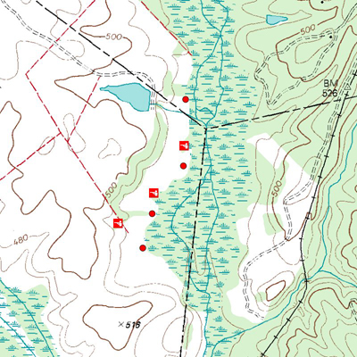
This is a Mississippi field-corner stand site. At times, a stand on the field edge will be productive while at other times you'll need to post inside the woods line- where the two creeks merge (especially for bowhunting). Note the stand sites also are near a creek drain, and the whole area is sandwiched between two lakes that help funnel deer. Outdoor Life Online EditorThis is a typical Alabama field hunting situation, with stands set for firearms hunters to most effectively cover the open areas. Points and corners of fields are choice spots, and stand selection should be made according to wind direction. Outdoor Life Online EditorAny type of barrier that funnels deer travel should be used to your advantage. In this case it's a Georgia lake, which deer skirt rather than swim across. Both ends of the lake provide good stand sites, especially the wide end where a dam is located. The dam area also has a large creek nearby that can help pinch deer travel toward a stand. The cut between the two lakes also has excellent potential to be a main travel lane for deer. Outdoor Life Online EditorBig ridge country can offer outstanding whitetail hunting, and sportsmen can utilize the rugged terrain features to help pinpoint deer. The two stand sites shown here allow hunters to overlook deer travel corridors. The creek drain has thick, tangled cover, which bucks usually stick to- they funnel between the creek and the steep ridge. Placing stands on the ridge overlooking the creek area is a good move. Hunters can expect to see deer where the red dots are located. The lake stand site could be particularly good, since the water and the ridge produce a tight travel bottleneck for deer moving through the area. Outdoor Life Online EditorThis is an excellent field deer-hunting situation. Any time a wooded strip or ditch drain exists between two agricultural fields, it forms a potentially good whitetail hunting spot. Both of these stand locations could be tops for gun or bowhunters. Firearms hunters can cover two fields for either stand. Bowhunters can pick off deer moving along the cover corridors in the woods strip. Outdoor Life Online EditorThis is a good example of how an aerial photo can sometimes reveal certain features not easily noticed on a topographic or even on a full-color aerial photo. This picture not only shows a lake that inhibits deer travel, but also reveals two ponds at one end of the lake funnels deer movement making them vulnerable to hunters. The two ponds are not easily seen on topo or color aerial maps. Outdoor Life Online EditorThis South Carolina spot has great deer hunting potential. Take a hard look tangled marshy area bordering this agricultural field and the island of timber in the field. This produces a secluded field-feeding area, with a man-made funnel at one end near the small lake. Field-edge stands at various spots are hunted according to wind direction. Red dots signify places where whitetails will likely be seen. Note that field edges on the opposite side of the marsh also have great hunting potential. Outdoor Life Online EditorPower lines always can be good for whitetails, and this spot is prime for several reasons. A prime stand location is on the steep ridgetop- visibility is long and excellent for riflemen. Two trails cross the power line in a draw (shown by a pair of red dots) where tangled creek draws meander across the mowed grass of the power line. On the opposite side of the ridge from the stand, a ridgetop flat falls off, making for a natural deer crossing. Note the access route to the stand from the ridgetop. Outdoor Life Online EditorThis is an aerial photo view of a Montana alfalfa field bordering a major river where a number of huge bucks have been tagged. Field-edge stands overlook holes in perimeter fencing that deer habitually use. Two stands near river islands can be rifle hunted, but are excellent bowhunting locations because of numerous trails leading from the thick island bedding areas to the field feeding area. Outdoor Life Online EditorThis Iowa creek drainage is surrounded by corn and soybean fields- some 150-inch bucks have been taken from it. Any of the stands can be exceptional, and choosing the best stand is always dependent on wind direction. For firearms hunters, being able to shoot open field land is wise. Bowmen usually stick tight to the creek, which acts as a deer funnel. Outdoor Life Online Editor
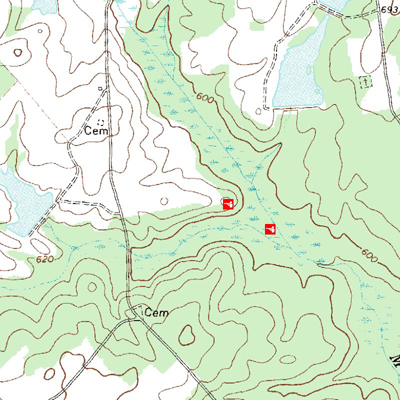
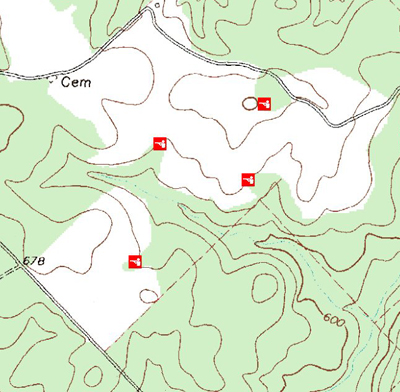
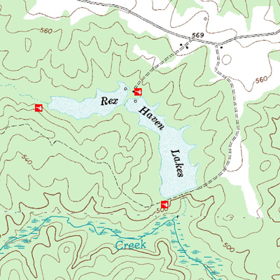
If you’re a serious whitetail deer hunter you need maps, both topographical and aerial. Each can reveal terrain features that the other overlooks. The following maps are real whitetail hot spots. Find similar terrain features where you hunt and you’ll be on deer all season long. By Bob McNally.