
We may earn revenue from the products available on this page and participate in affiliate programs. Learn More ›
The smartphone has become as vital a piece of gear for most hunters as our guns and bows. These little devices are good for texting buddies from the stand, playing games to stave off boredom, taking those annoying camo-centric selfies, and—yes—actually helping us to kill more critters.
As cell service has become more reliable and devices more sophisticated, the phones we carry in our pockets can do far more than make calls and snap photos. Most feature built-in GPS and available satellite imagery, and mapping detail is better than ever.
Battery life continues to improve, and portable chargers make it possible to employ a smartphone for hours on end while afield. The missing link has been applications made to harness all that technology.
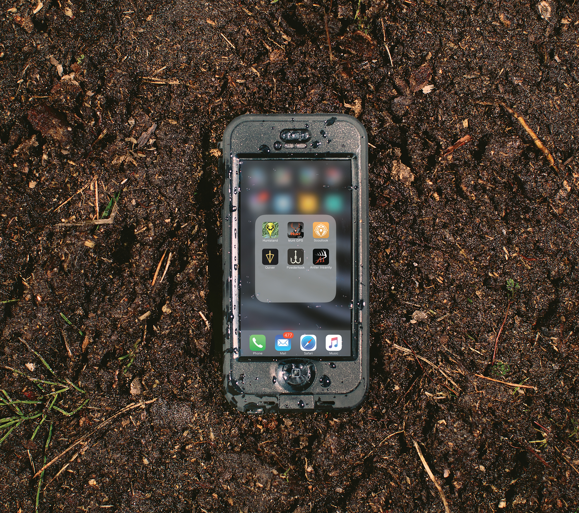
The world of hunting-focused apps is growing, and there are some top-notch offerings to be had. In this test, we take a look at nine apps focused on helping you find your way in the woods and making the most of your time once you get there.
1. TerraStride Inc. / HuntStand
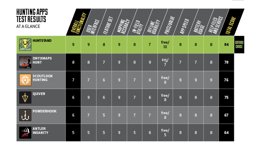
Overall Score: 84
HuntStand’s robust and useful feature set alone could have put it in a serious battle with onXmap’s Hunt for the title of Editor’s Choice, but the fact that it includes free parcel boundaries gave it the decisive edge.
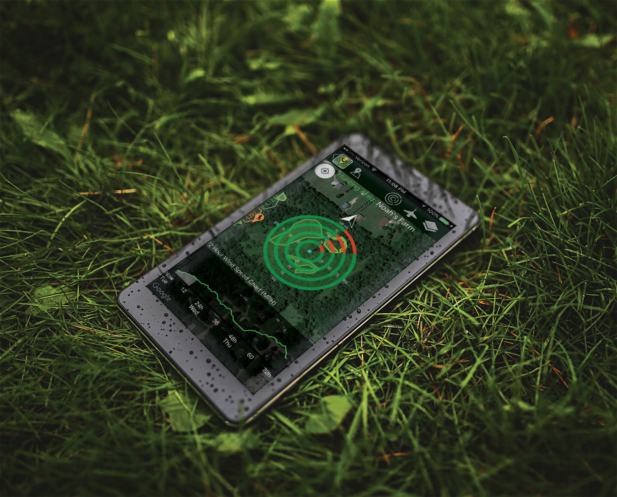
Let’s start with the mapping. HuntStand’s system allows you to choose an array of map views, ranging from satellite aerial imagery to topographic to standard views with road names. The maps function as expected, and image quality is excellent (so long as you have an adequate cellular signal). The parcel boundaries can be turned on or off, and they provide property lines. You will encounter some areas that do not offer parcel details (of the 14 Michigan counties I tested, two did not), and the boundary lines are all you get. No landowner information is provided on the app, though the desktop version does include those details, and you can’t tell which property is public versus privately owned, which is definitely a disappointment. Still, it’s the only app I’ve found that offers parcel boundaries at no charge.
Unfortunately, a recent update to the app limits the number of parcels you can tap for details to 10 per month, and it appears HuntStand may soon charge for additional parcel details.
Still, in-field applications are many. You can record sightings of game and create map boundaries. The weather feature is handy, if a bit clumsy. The overall user interface is intuitive and easy to master. It has a useful measuring tool for determining distance between points, and you can calculate acreage. One beef: The ads are annoying. But that’s to be expected of a free app.
The desktop version has even more features, and you can sync data from the field to the desktop.
2. onXmaps / HUNT
Overall Score: 78
The HUNT app from onXmaps has been the standard by which other apps are measured when it comes to in-field navigation and data management.
Prior to the creation of HuntStand , onXmaps was the only app available that allowed you to quickly view property boundaries in real time while afield. The app itself is free, but the property boundaries and parcel information layers require a subscription, with packages starting at $15 a month. The information is excellent, providing landowner information and acreage details, and it clearly differentiates between public and private lands.
The app does gobble a fair bit of data. HuntStand’s maps and layers opened more quickly than other apps tested—particularly in areas with marginal cell service. To save on data charges and for operating in areas where cell service is unreliable, you can download the maps to the app via wifi and open them at any time, regardless of cell coverage.
3. Hunt HUNTLOGIX, LLC / ScoutLook
Overall Score: 76
ScoutLook made its mark among hunting apps with the release of its weather-focused app and its ScentCone system. This feature indicates not only from which direction the wind is blowing, but it illustrates how the wind may spread your scent in the area.
ScoutLook Hunting’s mapping system is similar to most navigational apps, offering satellite imagery and using the phone’s GPS signal to mark your location. What stands out in ScoutLook are the weather options.
You can choose to view cloud cover and radar views, and cater the results to the type of game you’re hunting.
The forecast is detailed and includes everything hunters need—wind direction, barometric pressure, moon phase, and so on.
ScentCone and the app’s top-notch forecasting, plus its good-enough mapping system, creates a top-end free weather app. But it falls short on other hunter-focused features by comparison.
4. Quiver App Co. / Quiver
Overall Score: 75
Comparing this app to the others in the test is a bit difficult, given that its core functionality isn’t focused on mapping or navigation. But it is very much an app aimed at hunters, and thus worth including.
The launch page features a useful weather forecast. Nothing special here, really. Once you start hunting, however, the app comes into play and is pretty cool.
To start using the Quiver app, you simply tap “Start Hunt,” and the app will locate where you are, allow you to name the outing, and update the weather.
From there, you can record any activity you want, including deer sightings, and add notes, images, etc. Each time you record an event, the weather, time, and moon phase are captured. Over the course of the season, you should begin to see data trends.
Unfortunately, you need to do this deduction on your own. The app doesn’t offer any sort of analysis over time. This free app would be a lot more valuable if it had that functionality.
5. Powderhook Inc. / Powderhook
Overall Score: 67
Powderhook’s concept is simple: You need a place to hunt and fish; the app helps you find one. At its core, PowderHook is a mapping app that includes public land boundaries. It’s a simple function, and one that the app does well.
You can choose typical map overlay styles, including satellite imagery. Add public land boundaries and you can see at a glance where the nearest public ground is in relation to your location. Tap on any piece of public land and you’ll learn the name of the area and the available acreage, and you’ll be offered a link to the area’s online information. That’s essentially the extent of the app’s functionality as it relates to in-the-field mapping and data management.
The app does offer a social media component that allows users to connect and share information and content in a Facebook-like fashion.
Overall, it’s a solid app for locating public land, but it offers little else in terms of mapping features or in-field applications.
6. Antler Insanity
Overall Score: 64
This free app has been available in the App Store since 2012, and has seen significant updates and revisions since then. But, it still hasn’t gotten things quite right. The user interface is somewhat clunky, and the graphics package can’t compete with others tested.
One Antler Insanity feature that is useful in the field, particularly when you’re hanging a new treestand or hunting a new area, is the ability to mark your location in the field for later navigational use. But Antler Insanity’s roundabout interface makes it a frustrating process.
Marking property boundaries in the field is another feature that should see plenty of use. The trouble? It doesn’t seem to work. I tried several times to mark the boundary of a food plot but I couldn’t get the map to move over far enough to mark each corner.
The sunrise/sunset feature is solid and even provides civil twilight times. But that single benefit isn’t enough to overcome the other shortcomings of the app. ––Tony Hansen
The Final Hunting App Scorecard
Scout Your Hunt With 3 More Online Mapping Tools
Maps are the serious hunter’s best friend, especially when it comes to scouting. And in today’s digital world, there are a plethora of online mapping options available on your phone or tablet. We tested the various capabilities of four of the most popular online mapping tools by using them to remotely scout the same property. We compared the maps on their ease of use, detail, cost, mobile functionality, and coverage.
1. Google Earth
With its unique ability to change point of view and virtually fly across a 3D rendering of a property, Google Earth was the best tool for clearly showing the lay of the land. On a property such as the one we scouted, with its many fingers and ridges, this is a must-use feature. Google Earth also offers the ability to measure distances, see historical imagery of a property, and make custom markups.
Best For:
• Crystal-clear 3D rendering of topography
Disappointments:
• Lacks additional default overlay options
2. MyTopo.com
For a property with varied features, a true topographic map is a tremendous asset. And for high-quality, easy-to-navigate free online maps, MyTopo.com is a good choice, though it doesn’t have a mobile app. MyTopo offers satellite imagery and print options.
Best For:
• Viewing high-quality images of landscapes with significant terrain features
Disappointments:
• Not mobile-friendly
3. Bing Maps
For speed and simplicity, it’s hard to beat the basic map functionality of Bing. We were able to toggle between a road map, regular satellite imagery, and an angled bird’s-eye view all in a matter of seconds.
Best For:
• Getting a quick bird’s-eye view of a property
• Getting driving directions to and from property
Disappointments:
• Aerial imagery not always as clear as other sources’
• Lack of features such as distance calculator ––Mark Kenyon