We may earn revenue from the products available on this page and participate in affiliate programs. Learn More ›
The average outdoorsman is far removed from those 15th century sailors who navigated the world’s oceans. Today we rely on Global Positioning System technology, mapping apps, and the internet delivered through the latest and greatest smartphone. But the advantages that modern technology afford are incredibly fragile. They can be taken away in an instant by drained batteries, or simply lost. So what do you do when your electronics fail and you have to travel back in time to rely on the same skills as those seafaring seafaring explorers? You do what they did — use whatever you have at your disposal.
It Starts With Proper Planning
Long before you physically step into the field, you should travel there mentally through map reconnaissance. This is where all your preparation begins. It requires studying the terrain you’ll be in from a birds-eye view using a topographic map. Some satellite images provide photographic detail that would astound you. A good map can reveal locations of watering holes, nearby roads, and man-made features. Plus, the terrain you want to avoid including swamps, cliffs, and potentially dangerous ravines. These maps allow you to cover more ground with your eyes than you ever could with your feet. Good map recon will also help you determine which cardinal direction you should travel to hit any of these assets and if you have a basic understanding of how to use a compass (that you should always be carrying as a backup), you can set an emergency azimuth/bearing to get away from impending weather or to quickly travel for help in an emergency. With all this recon, you should take notes and keep a journal. In the field, it’s easy to forget where you are and what course of action you should take, but a journal never forgets.
Terrain Association
Terrain association is the practice of identifying the landscape around you and determining your place within it. From your map reconnaissance, you may have determined a particular stretch of river flows north and if you are walking against the flow, you know you’re headed in a southerly direction. Perhaps you identify a distinct flat-top mountain or a large field with a kidney-shaped pond in it. If you can identify and associate the terrain you’re in with a working memory of this terrain from your map recon, you’re much closer to a wayfinding solution.
Terrain association is best accomplished by looking for large features and working from the macro to the micro. Identify the largest mountain or the widest river then work your way to the smaller features like the trails that lead to or from them. If you have a hard copy of the map you used at home, you can more easily make your way. But you don’t need a full map, even a photocopy of a small portion of it will be better than working off your memory alone. Your map is packed with information you could not gather on your own without survey equipment and a lot of time on your hands. Learn to read topography using techniques like the hand method where peaks are knuckles, the space between knuckles are saddles, and fingers are spurs. Learn what terrain looks like on paper and compare it to what it looks like in real life. The more quickly and accurately you can identify terrain, the sooner you’ll be on your way.
Compass Skills
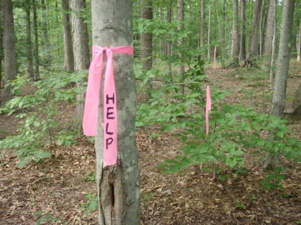
Before there was GPS, there was the compass. This navigation tool is phenomenal on its own for helping you travel in straight lines, along magnetic bearings. Even in the pitch dark or thickest fog, your compass can be illuminated and you can trust it. Assuming you are lost or your GPS runs out of battery power on the way back to your vehicle, you can mark your location with surveyor’s tape and scout your surrounding area. With a simple button or watchband compass, you can strike out cardinal directions and return on a +/- 180 degree opposite back bearing back to your starting point. Instead of aimlessly wandering through the woods and potentially making yourself more lost in the process, a compass removes one element of the unknown. But remember that your compass is not the perfect tool either. When you take compass bearings, make sure you keep it far from the metal in your wristwatch, the knife on your belt, and even the screws that hold the arms of your reading glasses on. The metal creates magnetic interference and that results in inaccurate readings. Believe it or not, there have been plenty of outdoorsmen who have actually used their compass on the hood of their car instead of putting the map and compass set on the ground.
Hunker Down
Humans fear the unknown. If our GPS is all we know, and then it unexpectedly dies in the field and we don’t have the regular updates it provides, it is safe to assume we’ll experience panic. This panic can act as a multiplier effect causing you to rush, make foolish decisions, and potentially get injured. Your clear-thinking mind will be distracted by the frustration over a lost comfort (in this case, your GPS). All this frustration can be exhausting and rather than push on to the point of weakness and fatigue, the better decision is to hunker down for the night. If you’re dressed appropriately for the weather, you can easily sit on your pack, build a fire, and rest up against a tree until sunrise. Even during the longest nights, you only must worry about surviving until sunrise. The rest you receive will help you see your situation with a fresh set of eyes and a restful mind. Think of this night out as an impromptu bivouac instead of an emergency scenario. Always look to reframe your scenario from a point of strength instead of looking at yourself as a helpless victim of circumstance.
Backup Your Backups
There is an expression, “one is none”. While I believe you should have a P.A.C.E. (Plan with Alternate, Contingency, and Emergency methods of navigation), I also believe that if something works well, then an identical backup could be carried. GPS technology has come down in price and the units have shrunk to wrist-mounted devices. If you have faith in technology and have tested it, it makes sense to carry redundant systems. I recommend you spread out your kit and what you carry. Your GPS may be an excellent navigation tool but make sure you have a good compass like the Suunto MC-2. Consider carrying a solid backup compass like the Suunto MC3. Mark your map with appropriate information and carry a small button compass in your map case.
When All Else Fails
You are your own first response and you can determine your self-rescue. There is no need to rely on anyone else and you should always ask yourself, “if not you, then who?” In other words, if you won’t help yourself, who do you think will? In a worst-case scenario, someone else will have to come to you to escort you out of the woods. Since we hope for the best but plan for the worst, it’s a good idea to leave a travel plan with a responsible party back home. By responsible, I mean a person who pays attention to you and isn’t distracted when you explain your travel plans. Additionally, this person should know what to do and who to contact if you don’t return within the window of time you specify.
Pack some effective communication tools. Tradition says to carry a small mirror and a whistle but, these often only convey distress to those who recognize them as such. More effective signaling devices include your cell phone, short-wave radio, and satellite communication devices like an In-Reach. Keep in mind, the same electronic vulnerability that caused your GPS may also impact these tools which will require you to protect them in your pack or on your person.
The Moral of the Story
You should have a good plan. Don’t just have any plan and don’t make your plan a plan to fail. Plan for your GPS to fail and manage your expectations. Make sure you have the skills to fall back on when technology buffers or doesn’t work as designed. Think of the explorers of the past and how map and compass skills worked for generations. They will continue to work as long you know how to use them.
