We may earn revenue from the products available on this page and participate in affiliate programs. Learn More ›
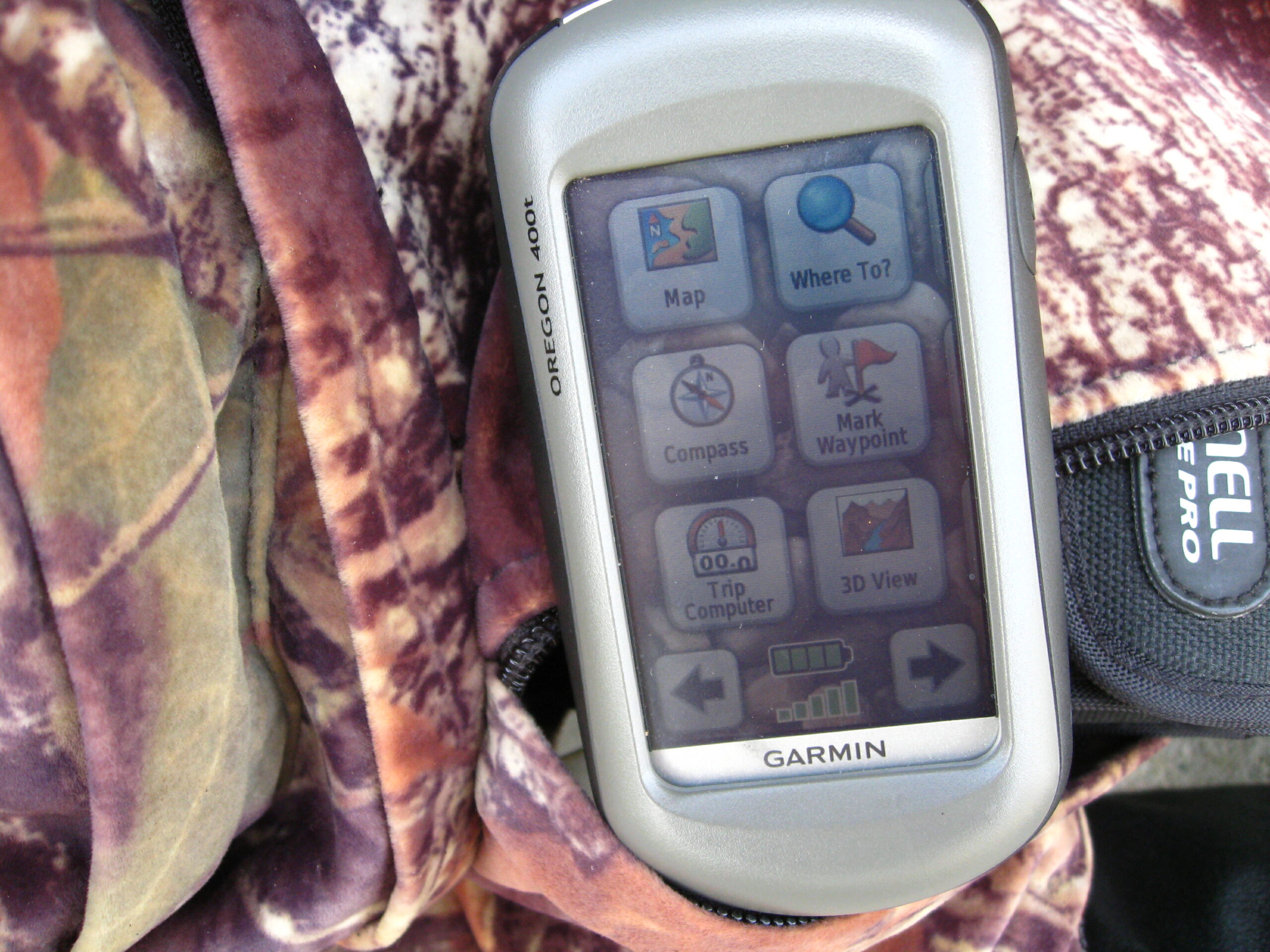
The Garmin Oregon 400t is simple to operate, and has just about everything a hunter would want, except perhaps a built-in rangefinder. Use it for scouting, hunting, or just to keep your bearings when you get turned around on unfamiliar hunting territory.
Techy, I’m not. However, there is one gadget I almost always carry in my backpack that has proved its worth on several occasions: a Garmin Oregon 400t. I bought it several years ago when I was preparing for a hunt in Montana, but I’ve gotten much more use from it in the South, while hunting everything from whitetails to cottontails.
GPS tells you where the rest of the world is in relation to you. While that might not sound like much, it’s a big deal if you’re hunting in a corner of a wildlife management area that’s unfamiliar to you, or you’re trying to get back to your vehicle in the dark while dragging a deer. At night, all ridgelines look pretty much the same, as do all the trees in a broad river swamp.
I don’t use the Garmin all the time. If I’m hunting home ground, it’s not necessary. There are a lot of times when a GPS is handy to have, however, and they don’t involve keeping you from getting lost.
1. SCOUTING
This is job one for my GPS, especially if I’m hunting property that’s unfamiliar to me. Using the Garmin’s touch screen pad, I waypoint the spot I want to return to, then start walking. As I wander around, I might add other waypoints, either by using the icons supplied in the unit, or typing out details that identify the waypoint better: RUBLINE, 10-POINTER JUMPED HERE, GOBBLER WING DRAG MARKS, SIX WHITE OAKS SURROUNDED BY PINES…and so forth. Not only am I able to note places that merit future investigation, but I begin to get a composite mental picture of the land that will help me make decisions about where I might hang stands or return to listen for a gobbler.
2. HANGING STANDS
Presuming I found enough clues when I scouted to warrant hunting an area in deer season, I’ll find and waypoint trees that are suitable for stands. I take into account likely wind direction during hunting season, my approach, and other pertinent information. I might record a waypoint and name it SOUTH WIND AM BOW, NORTH WIND PM GUN, or use one of the icons provided, then return later to hang a stand. Eventually, I might have five or six woods stands scattered around the property. The Garmin will get me to them and back again, in daylight or darkness. After hunting season, I can remove the stands without losing track of their locations because I’ve got them recorded in the GPS. When I review the season in my mind, I might go back and erase some of the stand sites that didn’t pan out, to make room for next season.
3. BLOOD TRAILING
In a perfect world, a deer goes down within a few dozen yards of where it was hit. In the world where I hunt, however, the deer sometimes goes a long way before it falls for keeps, and often it’s right at dark when it does. I might have to follow a circuitous trail to get to it, and wade through water along the way. The blood trail isn’t consistent, and sometimes I lose it, but at least I can mark the last sure sign and use that as a reference point of line-of-travel. Finally, once I do locate the deer, I know how to get back to the truck.
4. NOT GETTING LOST
Oh, yeah, a handheld GPS is good insurance against this, too. Often there are audio clues that help us keep our bearings: traffic noise from a nearby highway, planes taking off and landing at a nearby airport; trains passing on a railway. When you’re hunting unfamiliar ground or vast tracts of land where such references are unavailable, however, a GPS is good insurance. It tells you where you are, how far you’ve been, how far you’ve got to go and that sort of thing. I also carry a Brunton compass in my pack, but mainly for just-in-case. The Oregon 400t has a compass, but I figure if the GPS goes out, its built-in compass is likely to as well. Still, I carry two AA backup batteries.
When I first bought the Garmin handheld GPS I didn’t take a lot of time to read the manual, so I did a lot of fumbling around with the touch pad trying to figure it out. I’ve learned a lot about it since then, and Garmin also provided more help with a special tutorial website: www8.garmin.com/learningcenter/training/Oregon.
Garmin, Magellan, DeLorme—there are a number of good handhelds available now. Even the cheaper ones are good, and their price doesn’t necessarily reflect their quality. The more expensive models might differ only because they’re used for geocaching and have built-in cameras so that the searcher can show he’s found what he was seeking. Costlier models also might include digital maps of Europe and other continents. If you just want a serviceable GPS for showing you where you are hunting in the United States, however, you won’t have to spend several hundred dollars to acquire one.
If a handheld isn’t in your budget right now and you’re comfortable with using a smartphone and all it can do, check out some of the mapping apps that are available. I’ve owned the Garmin since before smartphones with GPS apps were introduced, and it and the Brunton compass for backup are all I need. Still, some of the new mobile apps work very well, once you learn how to use them. I don’t plan to; all my phone does is make calls when I need to: no cameras, no texting, no emails, no apps. When I’m out hunting, I sort of like it that way.