Photo by Bill Buckley
Opening day is a distant memory. It’s now the fourth quarter, and the ref just signaled the two-minute warning. How do you rescue your elk season? Map it.
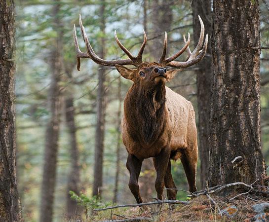
Your mapping skills can play a critical role during late-season hunts. In the majority of Western habitats, elk have one thing on their mind as daylight hours decrease. They’re looking for greener pastures, and that means migration. Some elk don’t migrate because they’re in habitat that’s hospitable year-round. But for most, deep snow is the trigger to vacate the high country for lowland oases.
Endpoints
A solid starting point for a “map-it” hunt is the location of documented winter ranges and likely migration endpoints. State and federal agencies manage crucial winter habitat to protect it from development and limit human activity during the winter months. Many are gated with posted dates of use. Use online state resources and make some phone calls to regional biologists to confirm the locations of these properties. Ask the biologists about the recognized traditional wintering areas and any secondary areas that might attract not hundreds, but possibly dozens of elk. If you don’t live in elk country but have friends who do, query them on where elk prefer to winter and at what elevation. Local ranchers and rural postal drivers should be at the top on your interview list, too.
Now locate these areas on your map. Elk habitually return to them year after year. Although elk may not be using traditional winter range during your hunt, you can use the information you gather to locate possible routes they will use to eventually get to the winter habitat. High-country saddles, passes, vast parks, and canyons that extend from the high country directly to the winter range below all offer ambush opportunities.
Isolated Elk
With several winter-range Xs marked on your map, your next step is to know the locations of roads and understand all the other information contained on your map. Begin by noting areas void of direct access and that lie uphill from the Xs. National Forest maps detail roads, trails, and trail access points, as do popular GPS programs like Hunting GPS Maps. Elk have been pursued since September and have learned that staying away from roads and trailheads means staying clear of humans. Scout for blocks of country that have two or more square miles of limited access; three or more is better. These sectors have the potential to hold elk on the way to their destination. They also serve as cutoffs when elk file into their winter range.
If finding elk in these spots still proves to be a challenge, take a step beyond roadless areas and look on topo maps for terrain few hunters would navigate. Steep, vertical slopes and rocky canyons intimidate flatlanders and out-of-shape hunters alike, but elk don’t mind the mountaineering challenge as long as they can find conifer stands and south-facing slopes nearby. These rocky retreats may hold elk well into December if their winter range is just a day or so away and snow depths remain manageable.
Of course, all of this goes out the window if Mother Nature decides an early winter is in order. Deep snow will push masses of elk low early, and close high-country access for hunters. Elk still may not romp across open slopes on winter ranges if this occurs, but expect to find them much closer to their winter grounds, taking advantage of reduced snow depths under tree canopies.
Maps aren’t guaranteed to plant you on a late-season herd, but they do have the ability to put you in the neighborhood.